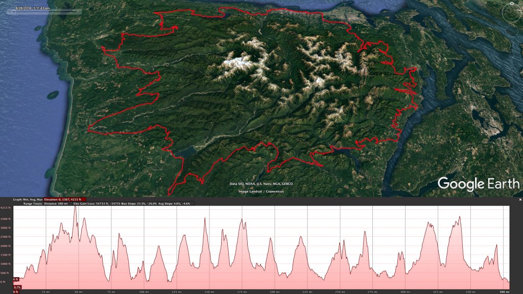
The route starts and ends in Port Angeles. We go in a clockwise direction, heading east from Port Angeles. The first few miles are on Olympic Discovery trail which is paved and offers a nice warm up before the climbing begins. The route is hilly with around 70,000 feet of vertical gain. There are plenty of bail options on most of the route except for the southern section between Lake Cushman and Lake Quinault. There is no resupply between those points. Water is abundant except on the tops of ridges and passes. Bugs have never been an issue but be aware for bears and cougars. Overall, resupply on route is very limited but can be found by going a few miles off route. A GPS unit with the route GPX file loaded is required for navigation. A spot tracker or similar is strongly encouraged.
The ride will be tracked using Trackleaders so please look for the signup link a couple of weeks before the start date.